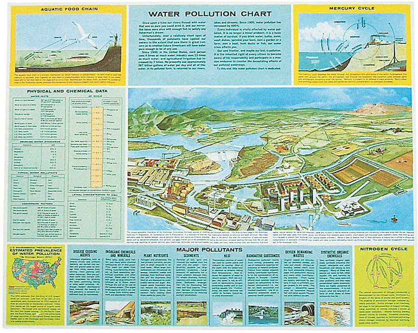
Water Pollution Chart for environmental science is packed full of informative text to support colorful drawings and provide answers to common questions about water pollution.
See more product details
Options:
(Select option to see volume pricing availability)
Product Details
Water pollution! What is it, where does it originate, how is it detected, how does it affect our environment, what can you do? This chart is packed full of informative text to support colorful drawings and provide answers to common questions about water pollution. Large center map details 47 water pollutants and methods for managing them. Table lists physical and chemical data. Detailed diagrams show the aquatic food chain and the nitrogen and mercury cycles, and a map shows the prevalence of water pollution in the United States. Printed on durable, heavyweight paper. Size: 28" × 22½".