Weather Map Chart for Earth science and meteorology is a four-color chart that clearly illustrates and defines the standard meteorlogical symbols and terms used in charting weather.
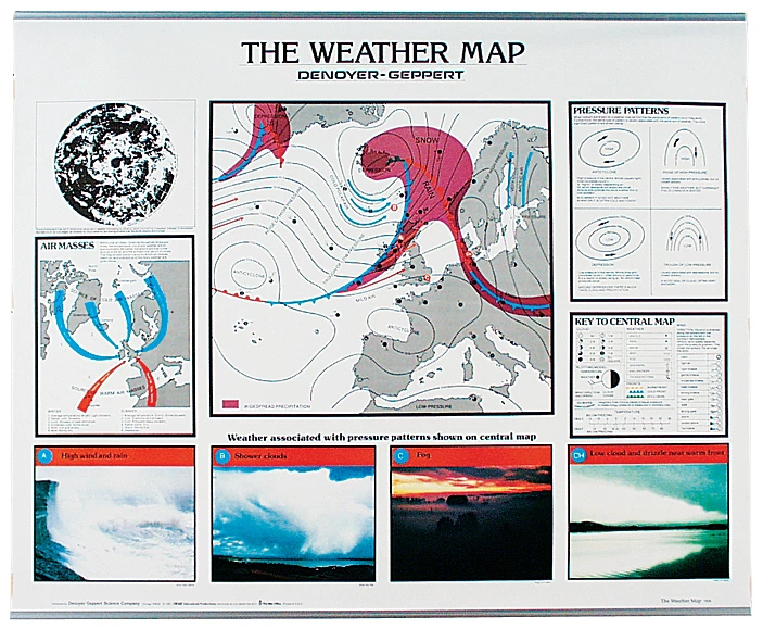
Learn how to read a weather map. This four-color chart clearly illustrates and defines the standard meteorological symbols and terms used in charting weather. Students will study a map of Western Europe and the British Isles and through a series of “chart keys” easily learn how to read a weather map. Color photographs of four actual weather conditions are also provided. Chart size is 44" × 36".